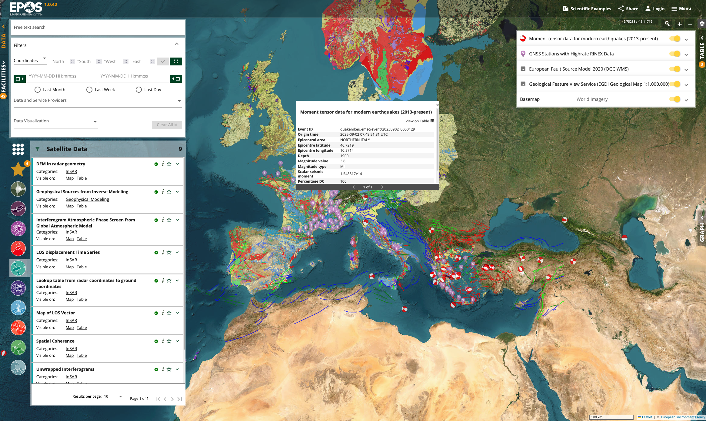
A Modern Map-Based Interface
Search, discover, and visualize geospatial data through an intuitive and modern web portal. The production environment of EPOS ERIC shares the same source code, which is constantly maintained, tested and supported. Built for researchers and data scientists.
Read the User Guide →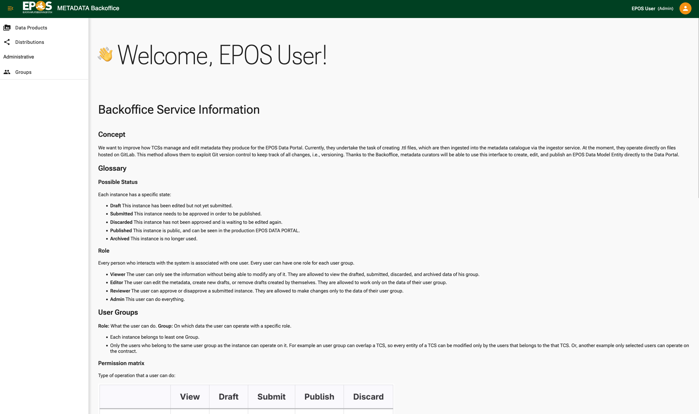
Powerful Data Management
Manage all aspects of your data services, system configurations, and user access through a comprehensive back-office graphical interface. The required metadata follows the EPOS-DCAT-AP profile.
Explore Back-Office Docs →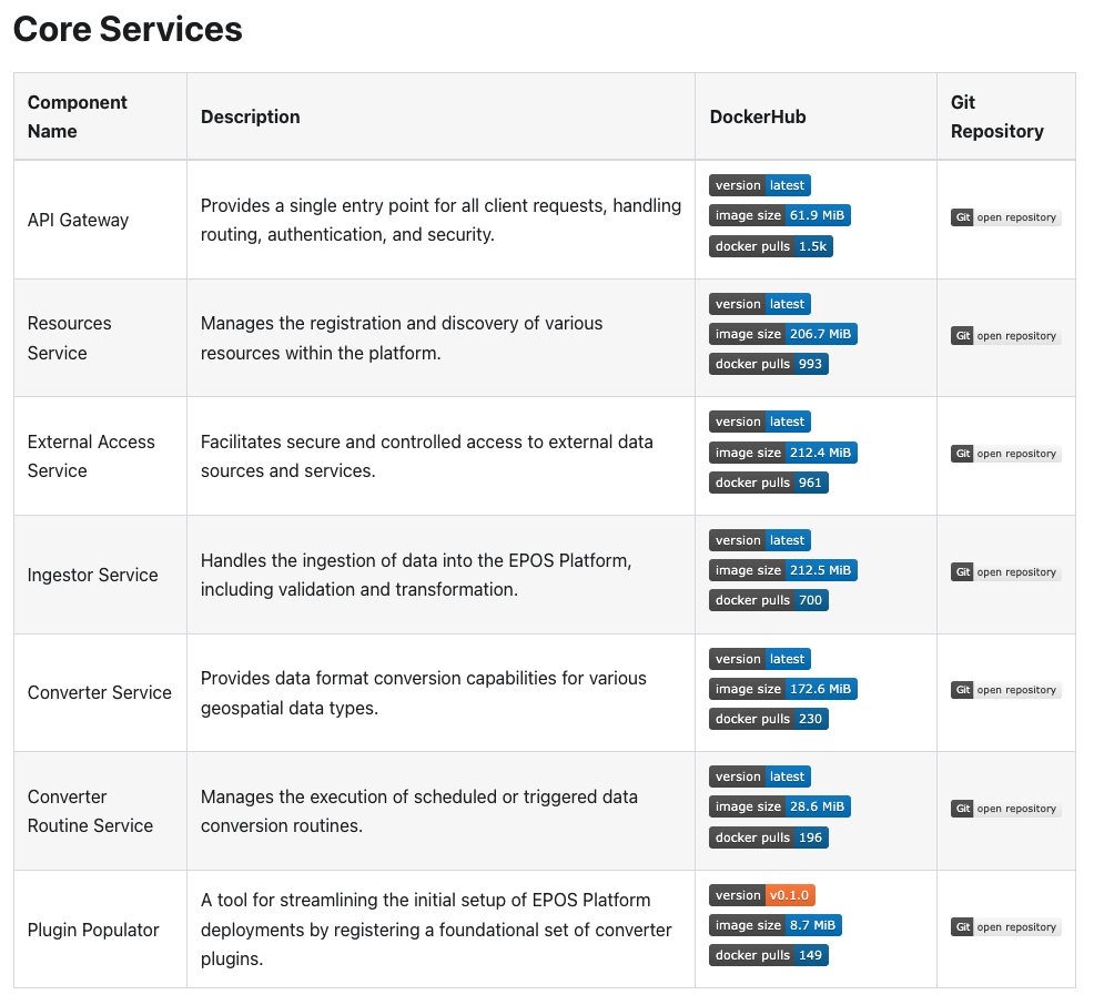
Contribute & Extend
Built on modern microservices architecture using Docker and Kubernetes. Extend the platform with custom services, contribute improvements, report issues, or fork it for your own and your institution needs.
Meet our contributor hall of fame →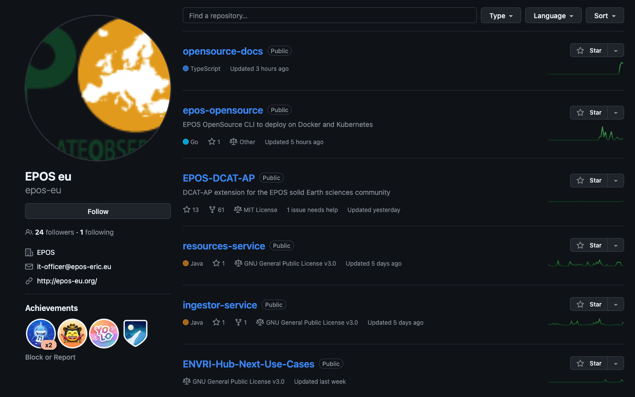
Free & Open Source
The entire EPOS Platform open source is released under GPL v3, making it completely free to deploy, modify, and use. Every component and library is open source and community-owned.
View License Details →Adopted Across Europe
The EPOS Platform Open Source is actively powering research infrastructures across Europe
About EPOS
The EPOS Platform is backed by EPOS ERIC (European Plate Observing System), a long-term research infrastructure supported by the European Commission. This open-source release makes the same technology powering pan-European Earth science data accessible to research communities worldwide.